Grand Staircase-Escalante National Monument is magnificent when you look from far. That is probably what people usually says and done, and that is only half right. You can’t believe that views on the road and on trails inside Grand Staircase-Escalante National Monument are also stunning if you didn’t go yet.
Travel Tips
- Check Cottonwood Canyon Road condition at Cannonville Visitor Center or at Big Water Visitor Center before you go. Need high clearance vehicle. If it has been raining, cottonwood canyon road could be too muddy to pass through.
- Get area map at either visitor center. There is no cell service and GPS may not have the detailed roads. It is good to have a map for reference.
In our trip plan, from Bryce Canyon National Park to Page in Arizona, we should cut through Grand Staircase-Escalante National Monument by Cottonwood Canyon road. However, Google Map circles around I-89 instead. We were puzzled and decided to ask local visitor centers. At Bryce Canyon National Park, a local shuttle driver also advised us to go only with 4-wheel drive during a hotel hot tub chat. We almost gave up the plan. On the way to Kodachrome Basin State Park, we inquired Cannonville Visitor Center. Staffs there are very helpful and have details on latest road condition. She ensured us that our SUV is totally fine. We double checked with a park ranger at Kodachrome Basin State Park. He also gave us a go ahead and recommended good places to stop by. This road trip turns out to be our most amazing scenic drive on this trip. We were kind of lucky going at right time on dry road. Two days later when we had chat with two ladies at Coral Pink Sand Dune State Park, they tried to drive through weeks ago from south by their sedan and road was so muddy that they had to turn back. So, before you go on Cottonwood Canyon road, it is a must to check with local visitor centers on road conditions.
Angel’s Palace Trail
Kodachrome Basin State Park has many great red rock trails. Park ranger recommended Angel’s Palace Trail to us. View is great, especially walking on a 5-feet-wide Angle’s-Landing-like double-cliff rigid.
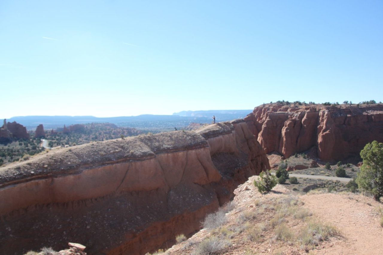
Both side are sharp drop-off like Angle’s Landing in Zion National Park
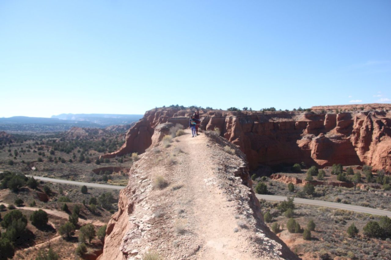
You have a panoramic basin view at the end of narrow ridge
We continue on Cottonwood Canyon Road after Kodachrome State Park Road junction. From this point, the road is totally unpaved. There is no mobile signal, no emergency phone booth, and no shelter. Your GPS might not show roads as well. You are totally on your own. Don’t forget to get a map from Cannonville Visitor Center. The map helped us a lot when we feel confused at cross-road. Along Cottonwood Canyon Road geological formations change drastically. You will love it even just driving by.
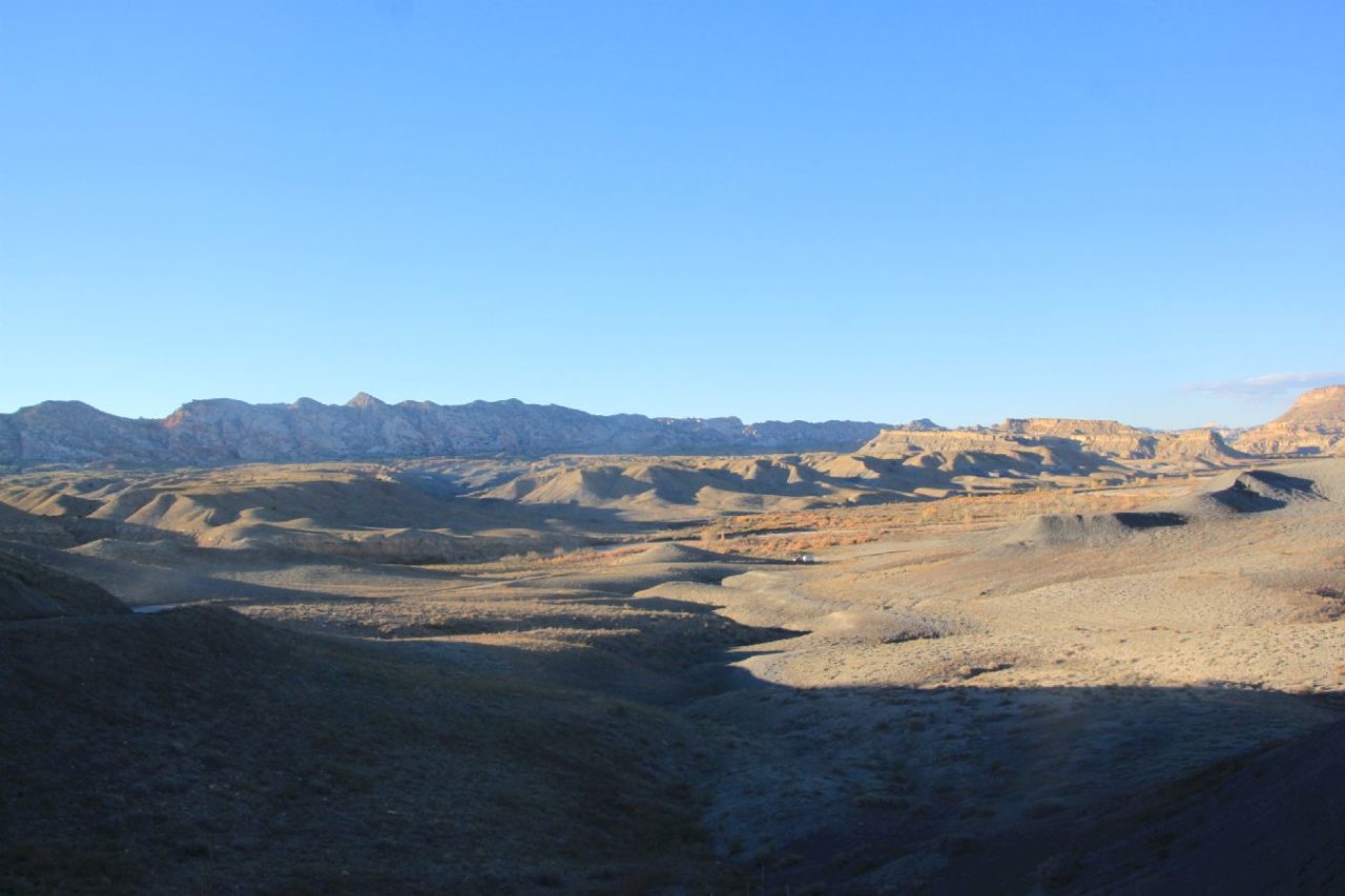
Cottonwood Canyon Road
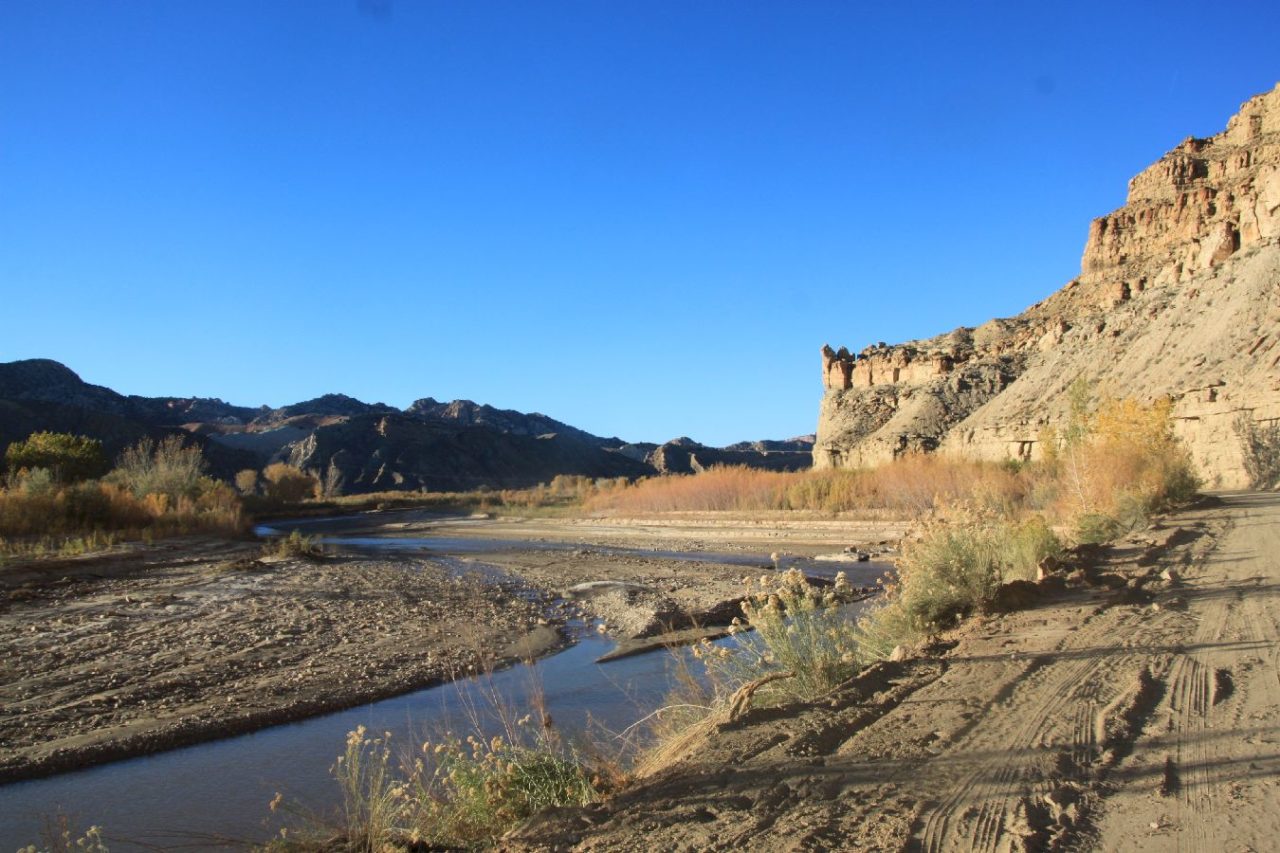
Cottonwood Canyon Road
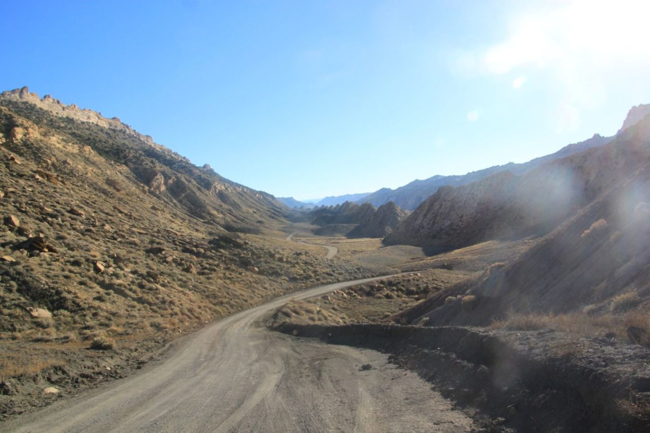
Cottonwood Canyon Road
Cottonwood Canyon Road
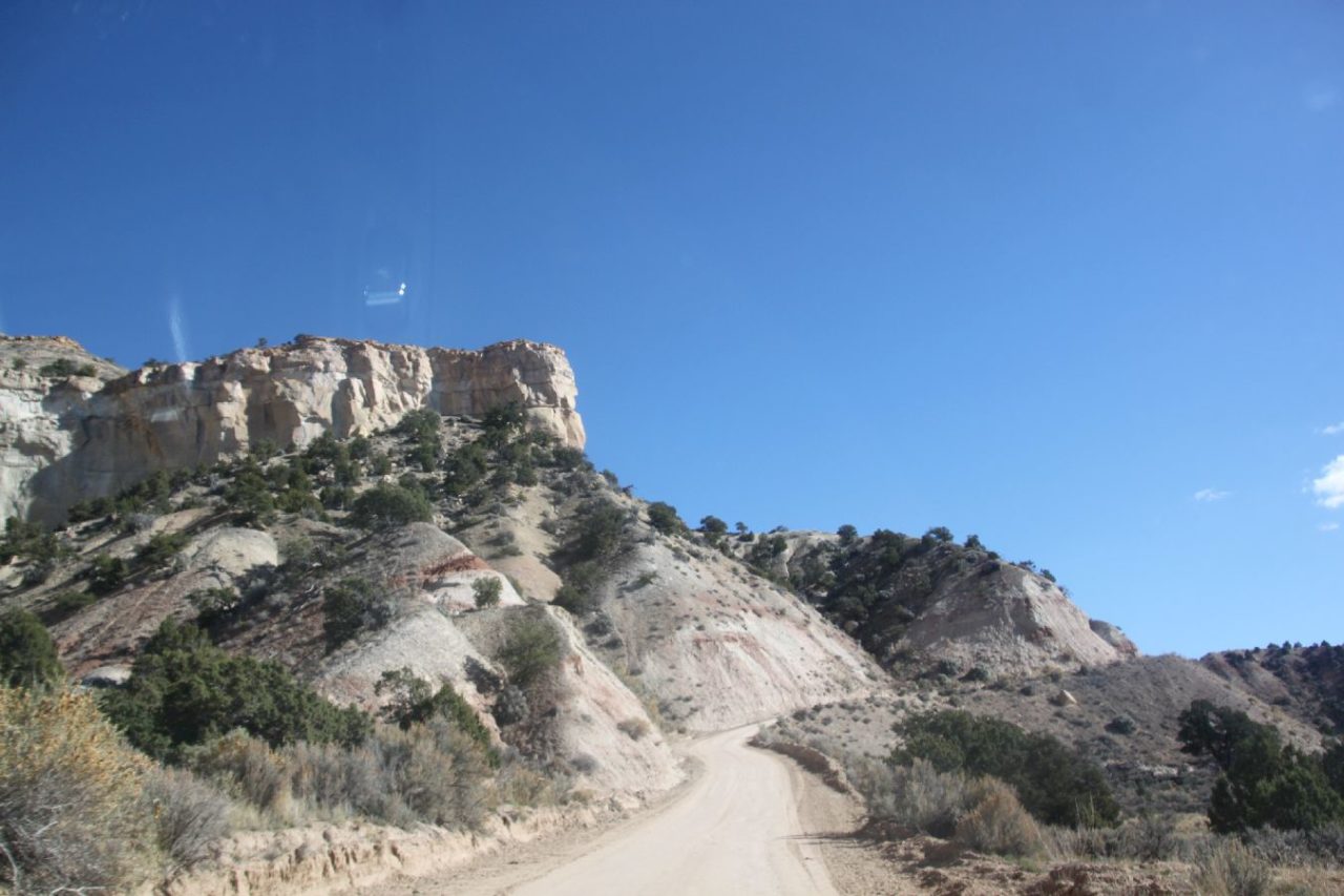
Cottonwood Canyon Road
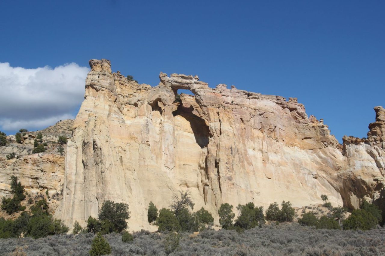
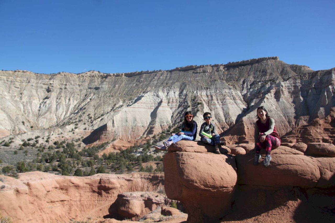
Grosvenor Arch
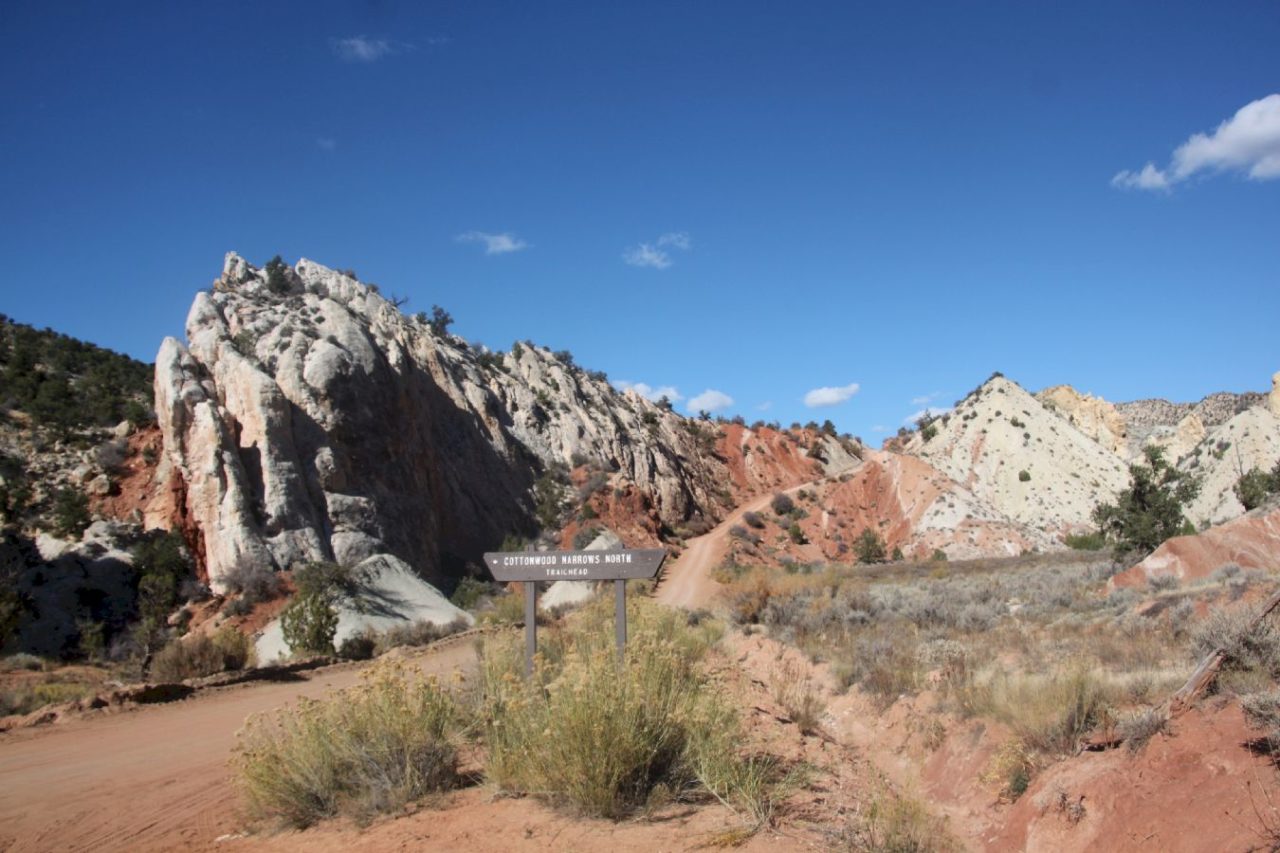
Cottonwood Narrows and are great to stop by. Grosvenor Arch is an easy walk and is the most popular stop, however, the true gem is Cottonwood Narrows. Check with visitor center if there are any flash flood warnings before going. If time allowed (2 hrs), I highly recommend Cottonwood Narrows. Especially when you are not able to hike The Narrows in Zion National Park, Cottonwood Narrows is a great alternative to you and little kids. There is a North Trailhead and a South Trailhead. You can enter from either, hike from one trailhead to the other or just hike a little bit then turn around. Pay attention to man-made rock pile on the canyon bed as stop point or register a satellite position to avoid walking beyond.
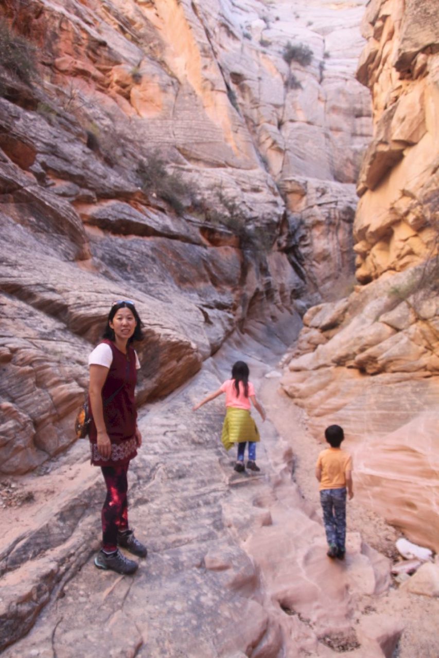
Cottonwood Narrows
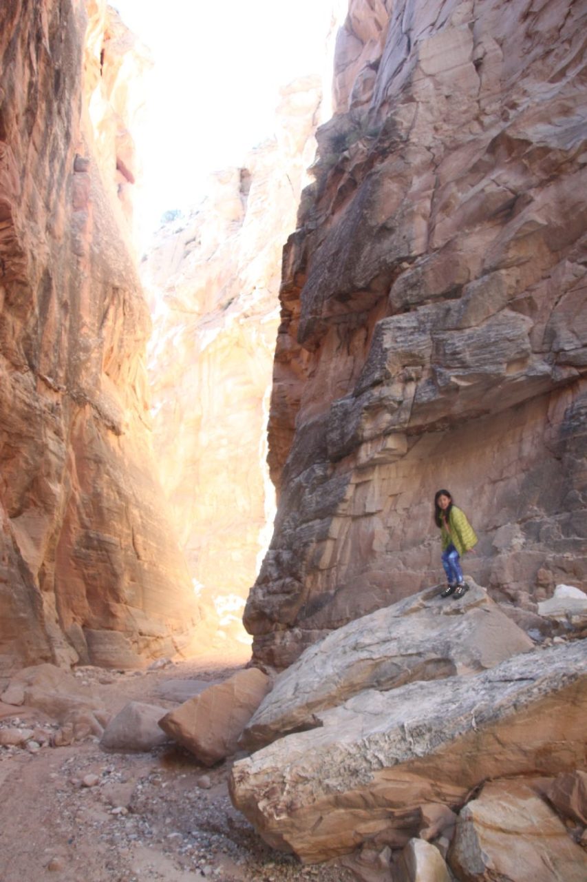
Cottonwood Narrows
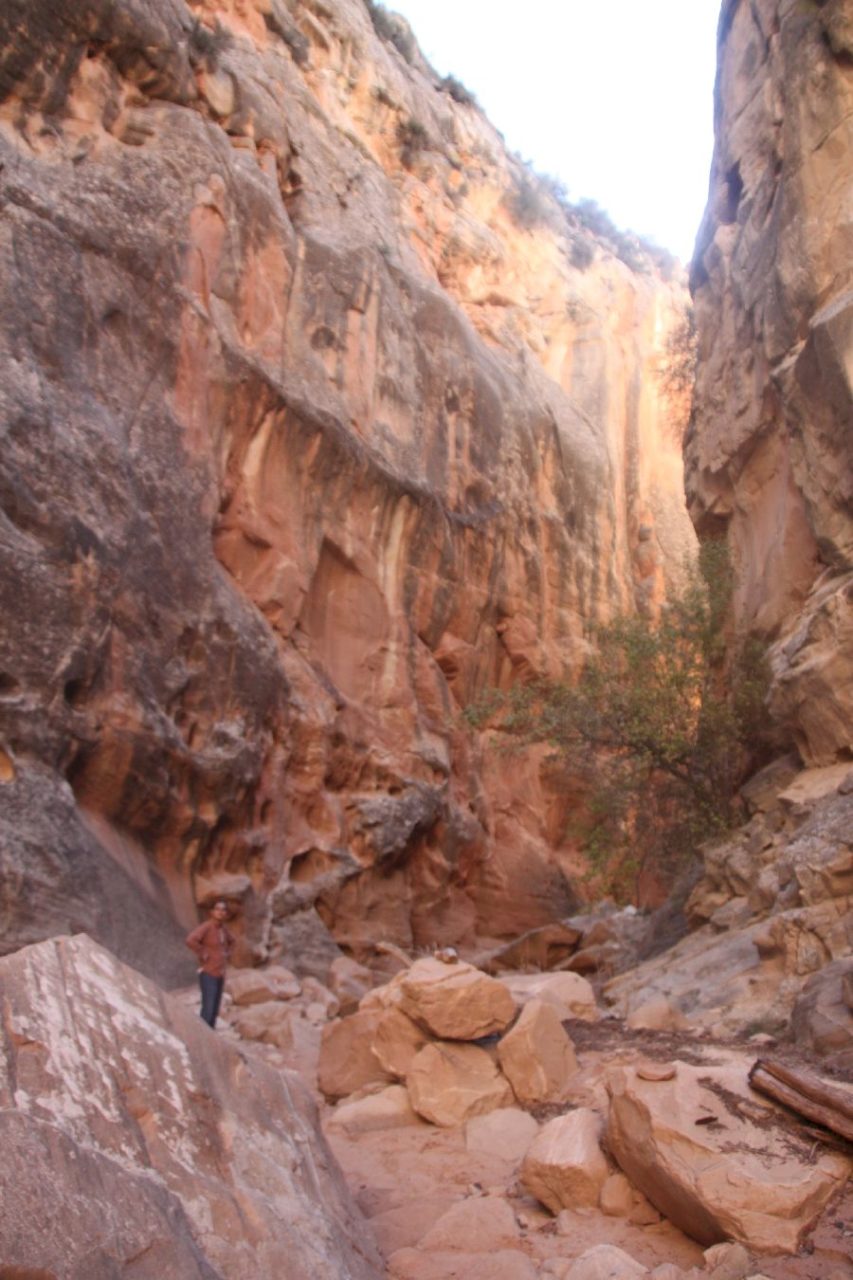
Cottonwood Narrows
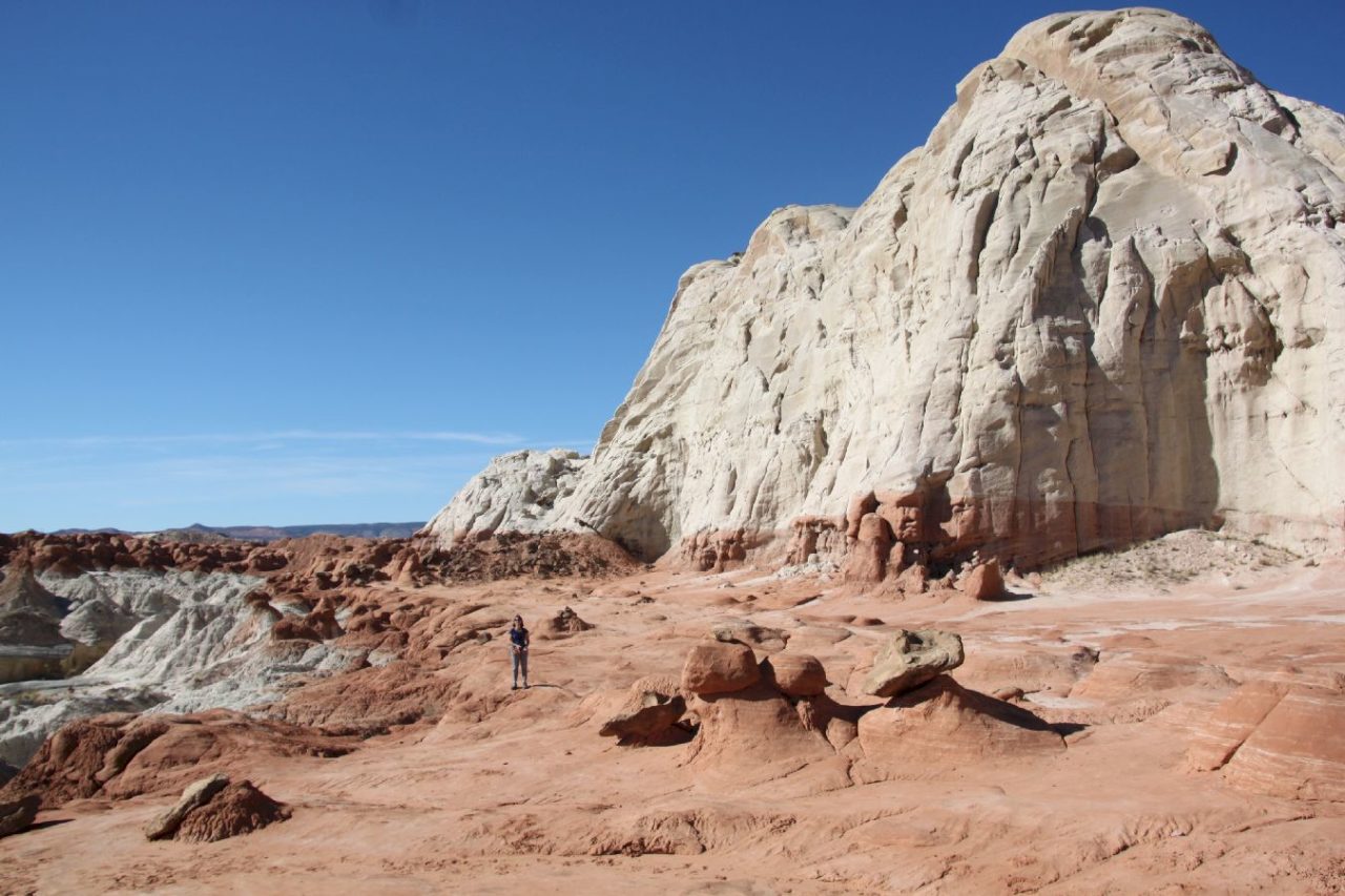
Another good Grand Staircase-Escalante stop is on I-89. We take this short hike another day when coming back from Page. At the end of trail, surreal rock formation is your big reward. Don’t just stop at trail end. What really great is behind the obstacle.
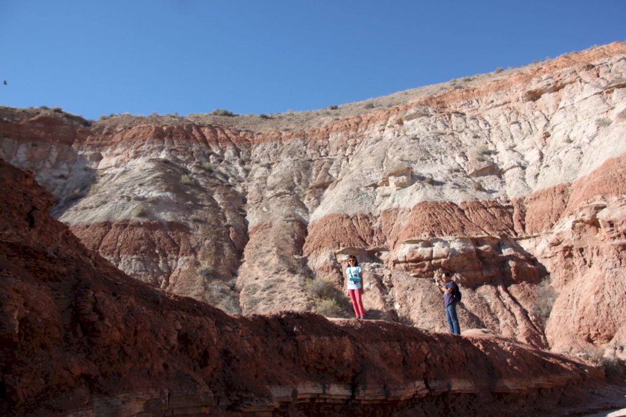
Half way on Toadstools Trail
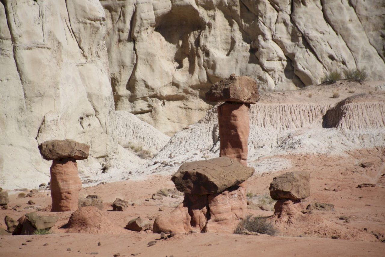
View after Toadstools Trailend
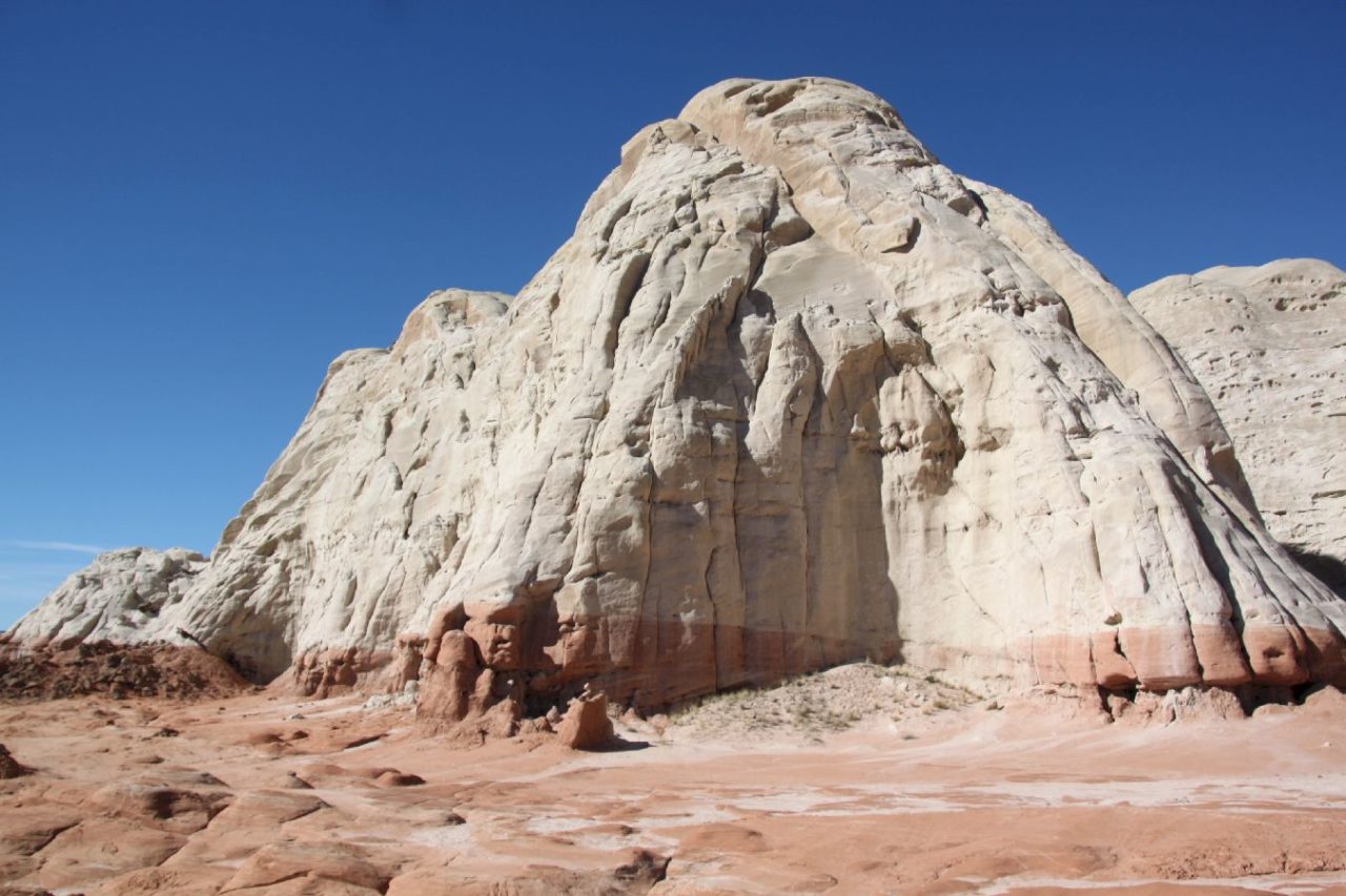
View after Toadstools Trailend
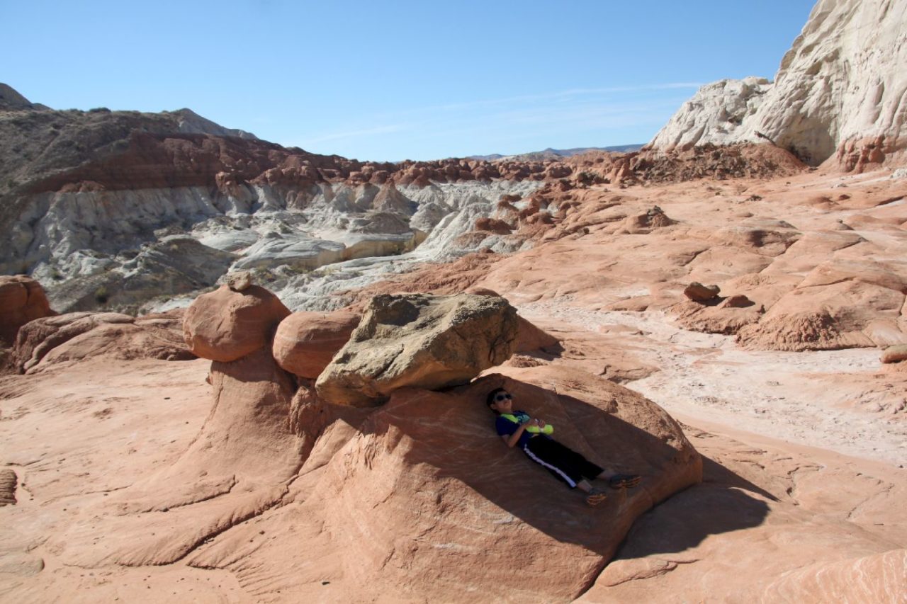
View after Toadstools Trailend
Enjoy sunset view of Grand Staircase-Escalante along I-89 when time is right. Unbelievable!
← Back to Summary
No Responses